

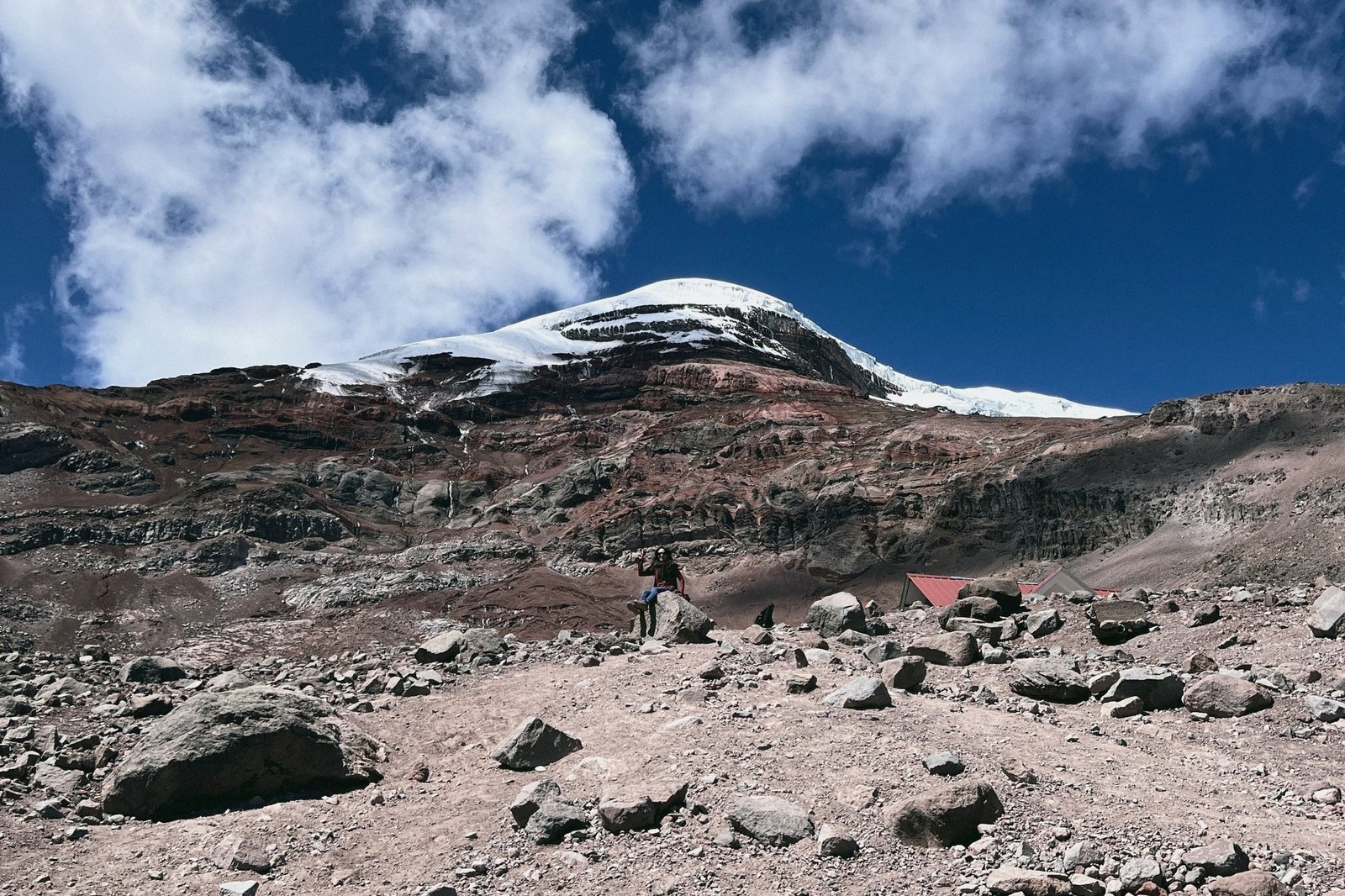
Everest is the highest mountain above sea level. Chimborazo wins a stranger contest. Earth bulges at the equator, and Chimborazo sits just one degree south of it, so its summit is the point on Earth’s surface farthest from the planet’s centre. According to NOAA, that’s more than 2,000 metres farther out than Everest’s top. Ecuadorians shorten it to “the closest point to the sun.” Strictly speaking, it’s the point farthest from Earth’s core. Either way, it’s a great line for your photo caption.
The best part for independent travellers: you don’t need a tour to stand on its flanks. The road goes most of the way up, entry is free, and in mid-November the slopes are white. El Comercio reported this week that the rainy season has brought frequent snowfall and more visitors.
Chimborazo in numbers
- Summit: 6,263 m (Instituto Geofísico, IG-EPN), Ecuador’s highest peak
- Location: about 150 km south of Quito, between Riobamba and Guaranda
- Status: potentially active; last eruption between the 5th and 7th centuries (IG-EPN monitors it)
- Protected area: Reserva de Producción de Fauna Chimborazo
- Entry: free, but registration with ID is mandatory
- Vicuñas: more than 7,000, according to El Comercio
This isn’t Cotopaxi National Park without a tour (a different volcano, closer to Quito) or Antisana’s condor country. Chimborazo is higher, drier at the base, colder at the top, and it’s the place to see wild vicuñas.
The free-entry rule, and the fake-fee warning
All of mainland Ecuador’s protected areas are free to enter. At Chimborazo you stop at the checkpoint, write your name and ID or passport number, and drive on.
In 2025, Expreso reported that some visitors were stopped at the access road by people demanding around USD 45 for “mandatory guiding.” The environment ministry said that’s not legal: entry is free, and a guide is only mandatory for groups of 16 people or more below the glacier. If someone blocks you and asks for money, stay calm, decline, register at the official checkpoint and tell the park rangers.
What is legitimate: paying for community transport from the checkpoint to the refuge if you arrive without a car. An independent guide lists it at roughly USD 25–35 per vehicle, but that isn’t an official rate, so agree the price first. Paying a certified guide you chose yourself is also fine.
How to get there on your own
Base yourself in Riobamba. The city sits at about 2,750 m, a sensible place to sleep before going higher. Quito to the reserve is roughly four hours by road, too long and too big an altitude jump for a comfortable same-day round trip, though people do it.
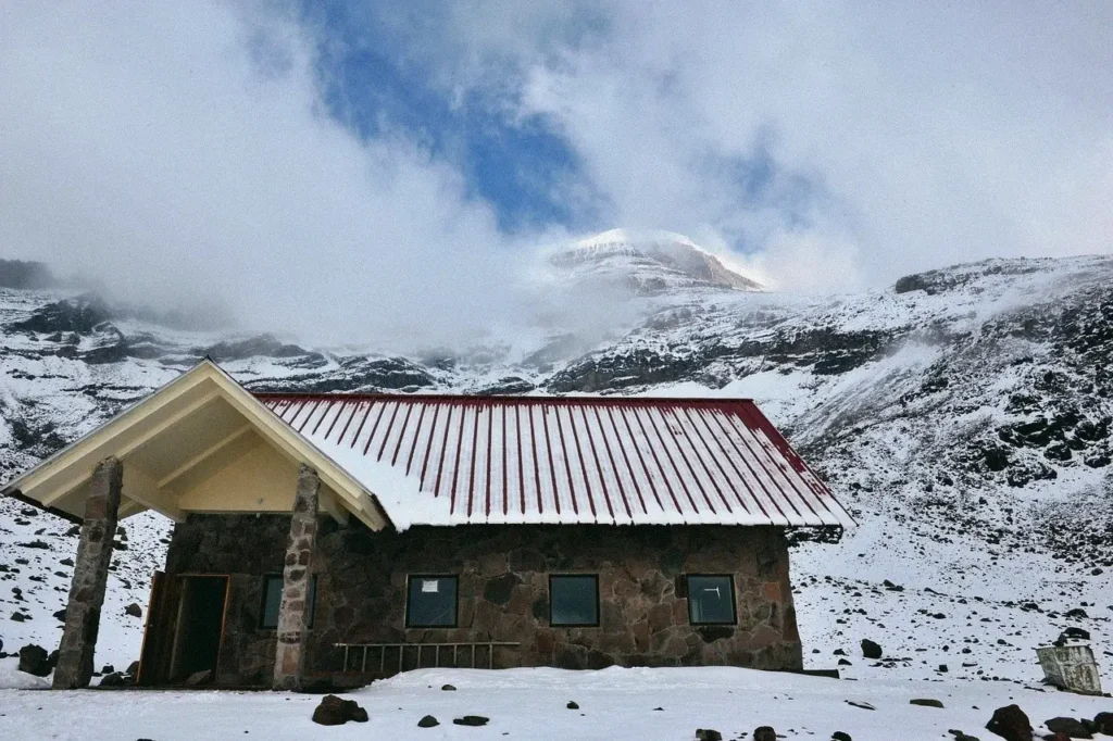
By car: Take the Riobamba–Guaranda road west to the reserve turn-off. After the checkpoint, a gravel road of roughly 8 km crosses the Arenal, a sandy high desert at about 4,300 m. It ends at the Hermanos Carrel refuge (about 4,850 m), where there’s parking and a café. An ordinary car can usually do it in dry conditions. In snow, drive slowly. El Comercio warns the road can ice over.
By bus: Riobamba–Guaranda buses can drop you at the reserve entrance. From there, arrange community transport up to the refuge, or walk the road (about two hours through vicuña country, and hard at this altitude).
What you can do without a guide
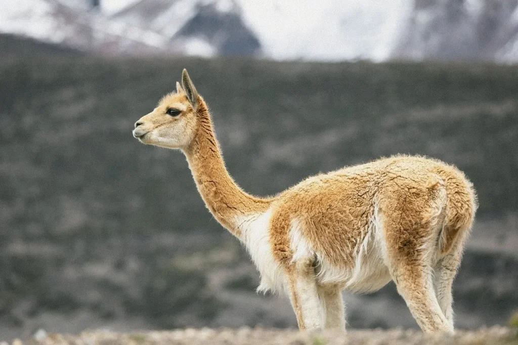
1. Vicuña spotting on the Arenal. The vicuñas were reintroduced in the late 1980s and have thrived. You’ll almost certainly see them from the car on the access road, slender and tawny with a white bib. Keep your distance, keep your dog at home (pets aren’t allowed), and don’t feed them.
2. The Carrel refuge (≈4,850 m). For most visitors, this is the end of the drive and the main event: glacier views, a hot drink and snow underfoot in season. Refuge hours are commonly listed as 08:00–16:00, but one listing shows entry hours ending at 14:00, so ask at the checkpoint what time you need to be heading down.
3. The walk toward 5,000 m and Laguna Cóndor Cocha (≈5,100 m). From Carrel, a trail of roughly a kilometre climbs to the old Whymper hut at about 5,000 m. The hut has been reported closed and run-down, so don’t count on any services there. About 500 m beyond is the small Cóndor Cocha lagoon. El Comercio confirms you can trek to the lagoon without a guide. It looks short on a map, but at this altitude 45 minutes can feel like a marathon. Go slowly, turn back if you feel unwell, and don’t go on if fog closes in.
With a guide (not on your own): Templo Machay, the Agujas de Whymper and, of course, the summit, which needs a certified high-mountain guide, acclimatisation and a midnight start. The upper mountain is glacier and rockfall terrain, and an avalanche in October 2021 was a sad reminder of the risk. That’s a different trip.
Timing: go early and leave early
El Comercio’s advice is that the best viewing window is roughly 11:00–14:00, because thick fog tends to roll in during the afternoon. Vicuñas are often more active in the morning. Our suggested day from Riobamba:
- 07:30 — Leave Riobamba with a full tank, water and snacks
- 08:30 — Checkpoint registration, then a slow drive across the Arenal for vicuñas
- 09:30–12:30 — Carrel refuge, then a slow walk toward Whymper and Cóndor Cocha if you feel fine
- 13:00–14:00 — Start down before the fog thickens
- Afternoon — Back in Riobamba for a hot lunch and an early night
Altitude, cold and what to pack
You’ll go from city altitude to nearly 5,000 m in an hour. General high-altitude advice (in the spirit of the CDC’s travel guidance) is simple: sleep lower before going high, move slowly, drink water, avoid alcohol, and go down if you get a bad headache, nausea or confusion. This isn’t medical advice. If you have heart, lung or blood-pressure conditions, or you’re pregnant, talk to a doctor before a high-altitude day.
Temperatures at the refuge typically sit around 0–12 °C, with wind and fog. Pack:
- Windproof and waterproof jacket, warm layers, gloves, a wool hat and scarf
- Sunglasses and strong sunscreen (the UV here is brutal even under cloud)
- Water, snacks and cash
- Proper shoes with grip for snow and scree, not trainers
Rules: no pets, no smoking, no fires, no single-use plastics, no litter (take everything back), and stay on the trails.
Pair it with
If Chimborazo hooks you on the high Andes, the Quilotoa Loop is a multi-day walking trip a few hours north. Cuenca-based? Cajas National Park is your lower, lake-filled alternative.
Stand on the snow at 4,850 m, breathe slowly and look up. On this mountain, you’re about as far from Earth’s centre as you can get without leaving the ground.
Sources
- IG-EPN, Chimborazo volcano page: 6,263 m; ~150 km south of Quito; last eruption 5th–7th century; potentially active, monitored: https://www.igepn.edu.ec/chimborazo
- NOAA National Ocean Service, ‘What is the highest point on Earth as measured from Earth’s center?’: Chimborazo’s summit is the farthest point from Earth’s centre, more than 2,072 m farther than Everest’s: https://oceanservice.noaa.gov/facts/highestpoint.html
- El Comercio (12 Nov 2026), ‘El Chimborazo está en su mejor temporada para el turismo’: frequent snow, best time 11:00–14:00 before fog, drive carefully on ice, car to first refuge, Riobamba–Guaranda bus to the reserve entrance, ~4 h from Quito, 7,000+ vicuñas, trek to the lagoon without a guide: https://www.elcomercio.com/actualidad/ecuador/volcan-chimborazo-turismo-invierno-nieve/
- Expreso (2025): free entry to protected areas; reports of people demanding USD 45 for ‘guiding’; guides mandatory only for groups of 16+; Carrel refuge reopened 2022; refuges reported lacking water/electricity in June 2025: https://www.expreso.ec/buenavida/hay-que-pagar-para-ingresar-al-chimborazo-lo-que-debes-saber-antes-de-viajar-254865.html
- Primicias: free entry with registration; Carrel ~4,845 m by car; refuges 08:00–16:00; temps 0–12 °C; packing list: https://www.primicias.ec/entretenimiento/volcan-chimborazo-nieve-paseo-turismo-feriado-88477/
- DescubrEcuador listing (Reserva de Producción de Fauna Chimborazo): free entry; register with ID; no smoking, fires, single-use plastics or pets; listed hours 08:00–14:00: https://www.descubrecuador.com/item/reserva-de-produccion-de-fauna-chimborazo/
- Volcano-guide.com (independent; checked 22 Sep 2026): 8 km gravel road from El Arenal checkpoint; Whymper hut closed; ~1 km / 45 min to Whymper and +500 m to Cóndor Cocha; community transport USD 25–35 per vehicle (unofficial); vicuñas reintroduced 1988; October 2021 avalanche: https://volcano-guide.com/en/chimborazo/
- CDC Yellow Book, High-Altitude Travel and Altitude Illness (403 to box; general guidance only): https://www.cdc.gov/yellow-book/hcp/environmental-hazards-risks/high-altitude-travel-and-altitude-illness.html
- Cover photo: PHOTO: “Nevado Chimborazo, el más alto del mundo” BY JIM MORRIS / PEXELS (PEXELS LICENSE), EDITED